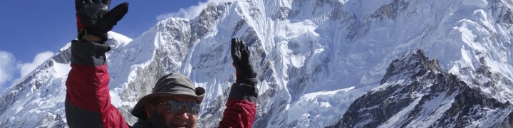
Blog Post 2
May 17 to 19, 2016
Exploring the Ancient Inca Ruins in Cusco State and practice hikes to prepare for the Inca Trail
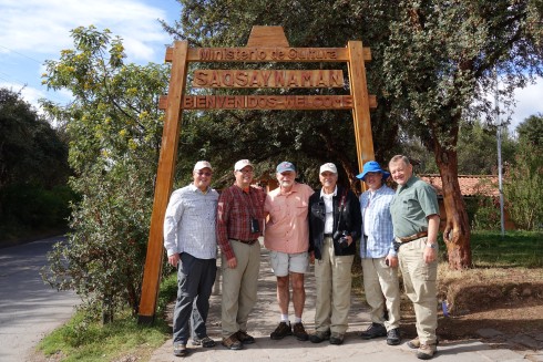
Tuesday, May 17: Day 3
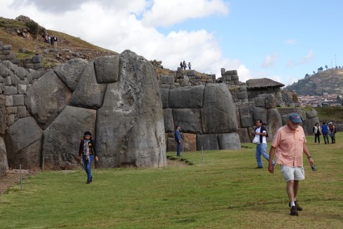
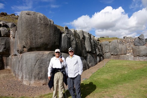
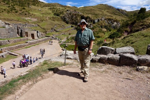
Saqsaywaman
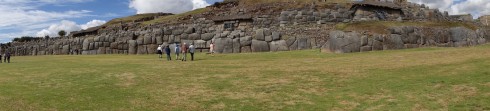
Saqsaywaman is a citadel on the northern outskirts of Cusco,, the historic capital of the Inca Empire. Sections were first built by the Killke culture about 1100. The complex was expanded and added to by the Inca from the 13th century; they built dry stone walls constructed of huge stones. The workers carefully cut the boulders to fit them together tightly without mortar. The site is at an altitude of 11,200 ft.
In 1983, Cusco and Saksaywaman together were added to the UNESCO World Heritage List for recognition and protection.
Located on a steep hill that overlooks the city, the fortified complex has a wide view of the valley to the southeast. Â Archeological studies of surface collections of pottery at Saqsaywaman indicate that the earliest occupation of the hilltop dates to about 900AD.
Located on a steep hill that overlooks Cusco, the fortress has a wide view of the valley to the southeast
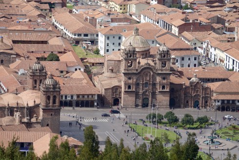
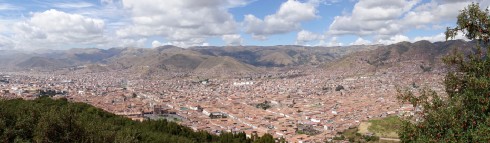
A view of the Plaza de Armas in Cusco from the Saqsawayan hill
The Inca used similar construction techniques in building Saqsaywaman as they used on all their stonework, albeit on a far more massive scale.Â
Bill Riat in front of one of the massive stones
The stones were rough-cut to the approximate shape in the quarries. They were dragged by rope to the construction site, a feat that at times required hundreds of men.  The stones were shaped into their final form at the building site and then laid in place.
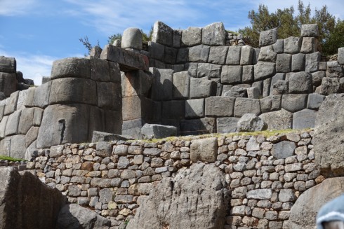
The work, while supervised by Inca architects, was largely carried out by groups of individuals fulfilling their labor obligations to the state. In this system of mita or “turn” labor, each village or ethnic group provided a certain number of individuals to participate in such public works projects.
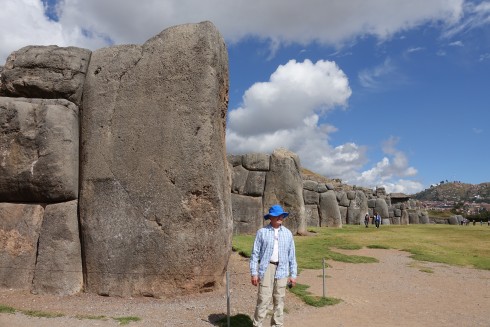
Jim Macklin in front of a stone that must weigh 100 tons!
After the Battle of Cajamarca during the Spanish Conquest of the Inca in the 1500s, the Spanish found the Temple of the Sun “covered with plates of gold”, which the Spanish removed along with priceless other treasures.
Jim Simon an Dave Jordan
After Francisco Pizarro finally entered Cuzco, his brother Pedro Pizarro described, “on top of a hill they [the Inca] had a very strong fort surrounded with walls of stones and having two very high round towers. Â And in the lower part of this wall there were stones so large and thick that it seemed impossible that human hands could have set them in place. Â They were so close together, and so well fitted, that the point of a pin could not have been inserted in one of the joints. Â The whole fortress was built up in terraces and flat spaces.” (https://en.wikipedia.org/wiki/Saksaywaman)
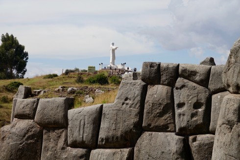
We spent considerable time admiring these amazing buildings, climbing to the highest point to get the best view of the full expanded complex.
***************************************************************
Tambo Machay
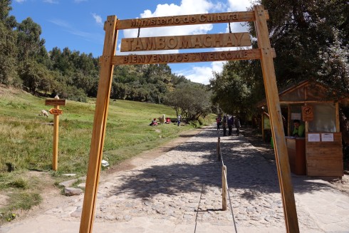
A steep path provided us with our first hike of the day, as we made our way up to the ancient ceremonial place.
Tambo Mackay ceremonial baths with the four display sports where the embalmed bodies of deceased royalty were placed during the annual ceremonial bath
Tambo means guest house, machay means cave.  An alternate Spanish name is El Baño del Inca (“the bath of the Inca”).  It consists of a series of aqueducts, canals and waterfalls that run through the terraced rocks. The function of the site is uncertain: it may have served as a military outpost guarding the approaches to Cusco, as a spa resort for the Incan political elite, or both.  An annual ritual involved taking a bath in the crystal clear spring, with the embalmed bodies of the deceased kings being placed in four spaces above the spring
As in so many places on this journey, the locals were displaying their many colorful wares for purchase along the path.
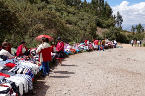
The locals were displaying their many colorful wares for purchase along the path.
***************************************************************
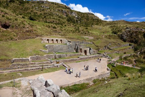
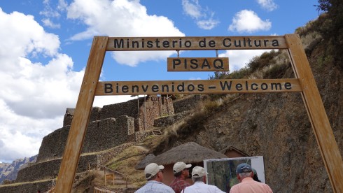
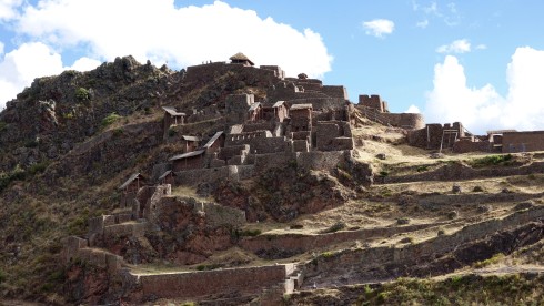
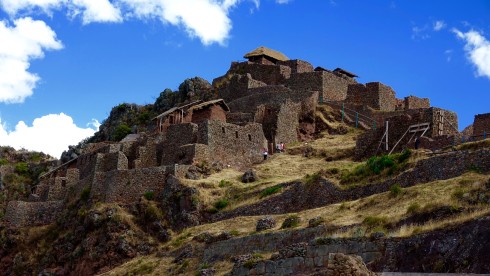
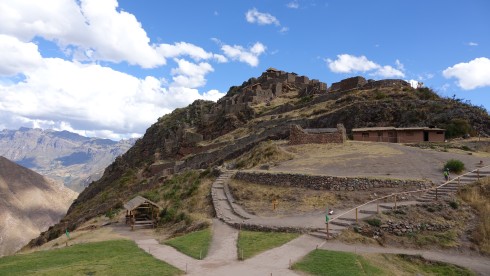
Pisaq
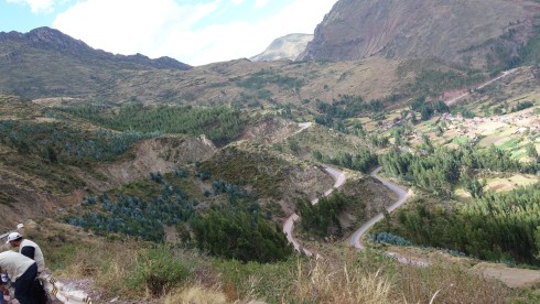
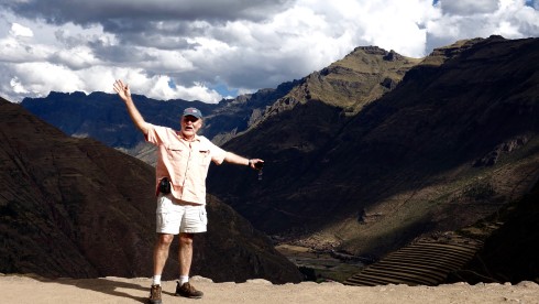
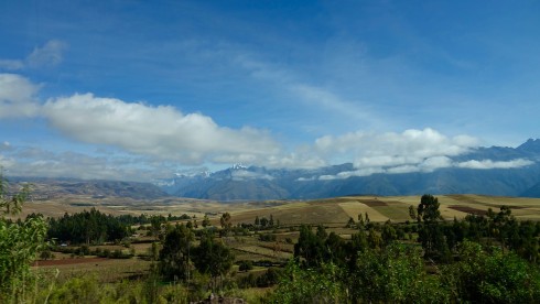
On the way to Pisaq we travelled through some of the most beautiful mountain scenery, and stopped at a lookout point above the village of Ccorao, surrounded by beautiful farmland in the fertile valley below.
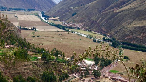
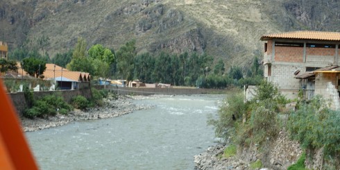
This was also our first view of the Urubamba River, which flows all the way to Machu Picchu and beyond.
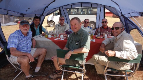
We had lunch in the charming town of Pisaq, and explored the very extensive market.
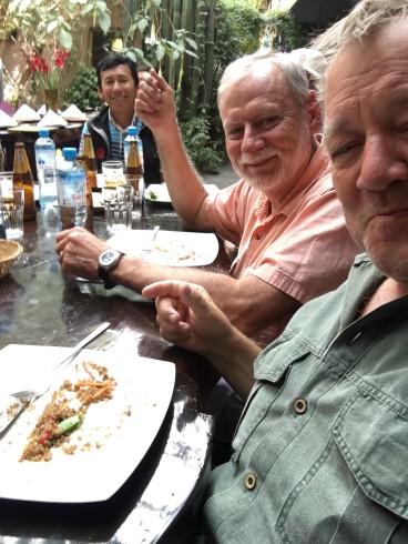
Willie and Bill at lunch in Pisaq. Our wonderful guide, Thomas in the background
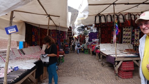
The market in Pisaq
After lunch we piled back into our van for the drive up to the famous ruins at Pisaq.
The Inca constructed agricultural terraces on the steep hillside, which are still in use today. They created the terraces by hauling richer topsoil by hand from the lower lands. The terraces enabled the production of surplus food, more than would normally be possible at altitudes as high as 11,000 feet.
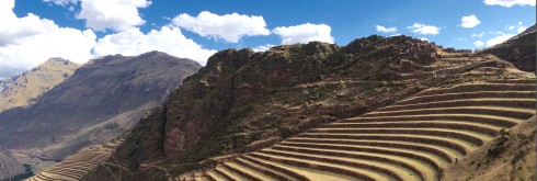
With military, religious, and agricultural structures, the site served at least a triple purpose. Researchers believe that PÃsaq defended the southern entrance to the Sacred Valley, while Choquequirao defended the western entrance, and the fortress at Ollantaytambo the northern. Inca Pisaq controlled a route which connected the Inca Empire with the border of the rain forrest.
This was our first opportunity to experience some serious climbing as we made our way o the top of the mountain fortress and temple.
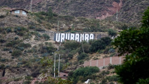
Exhausted we drove down the switchbacks and on to Urubamba to check in at our hotel, the Tambo del Inka.

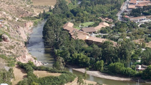
Tambo del Inka Resort on the banks of the Urubamba River
>>>>>>>>>>>>>>>>>>>>>>>>>>>>>>>>>>>>>>>>>>>>>>>>
Wednesday, May 18: Day 4
Chinchero
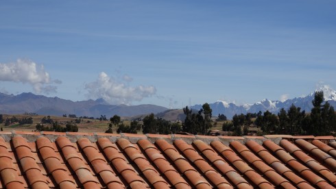
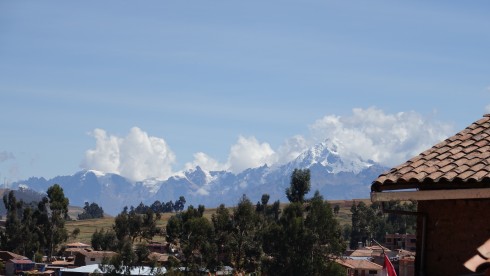
We took a scenic drive from the valley up to onto a highland plateau to visit the market town of Chinchero (12,398 ft.), passing through farmland areas with a patchwork of beautiful fields and adobe houses with red tiled roofs. The snow-capped Andes mountain were spectacular in the morning sun.
The snow-capped Andes mountain were spectacular in the morning sun.
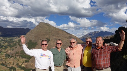
At a lookout point we stopped to admire the view and pose for a group photo…
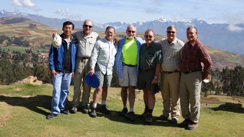
Our guide, Thomas, Dick Alkire, Jim Macklin, Bill Riat, Wilie Grov̩, Dave Jordan, Jim Simon Рthe snow-capped Andes behind us.
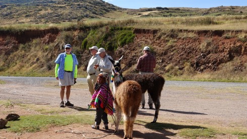
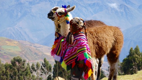
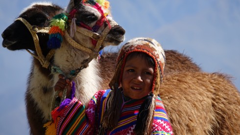
…and we enjoyed watching the local farmers at work…
We had a lovely time photographing a mother and her young daughter with their alpaca.
We continued to Chinchero, which we found a most interesting place.
Also known as The City of the Rainbow, Chinchero is located 28 km. northeast of Cusco at an altitude of 12,400 ft. It is situated midway between the highlands and the warm valley, and is surrounded by the snow-clad mountains of Salkantay, Veronica and Soray. The view from here is impressive.
Chinchero, the most typical town in the sacred Valley of the Incas, is an Inca city which the conquerors wanted to “civilize” and establish their culture, but they were never able to achieve it completely. Its inhabitants live in the almost untouched Inca constructions where their ancestors lived and built the greatest and most prosperous civilization in America.
The current population of Chinchero lives in an old pre-Hispanic settlement and is one of the most representative remains of early Andean cultural resistance. Its settlers, dressed in multicolored clothes, maintain their Indian race, only speak Quechua and still keep their age-old customs which they refuse to abandon.
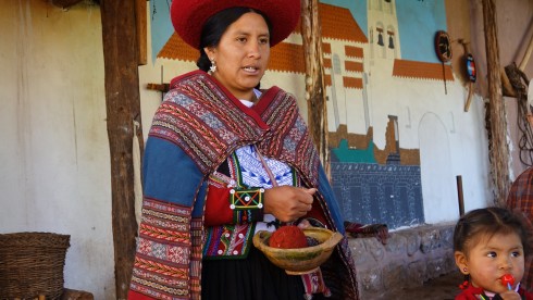
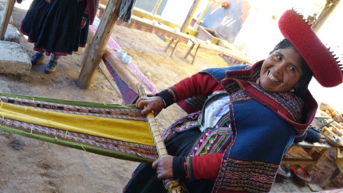
We were fortunate to enjoy a presentation of traditional weavers, who served us fresh mint tea right from their garden.
*******************************************
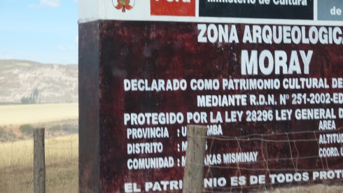
Moray and The Salinas Salt Works
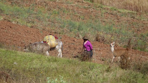
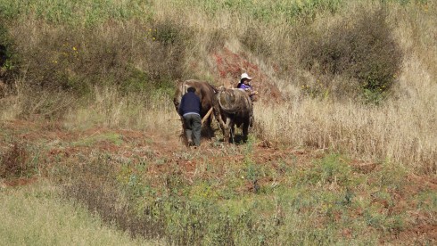
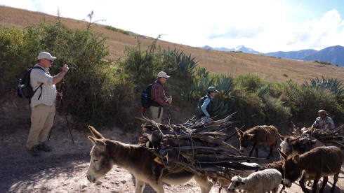
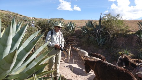
We continued on to the impressive earthworks at Moray, but stopped on the way to observe some people harvesting potatoes, and making a fire in an earthen oven to cook their lunch of potatoes.
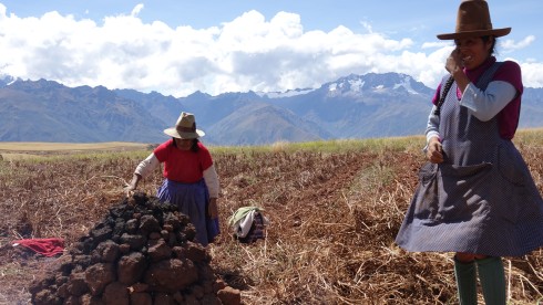
Women preparing fire in mud-oven to cook potatoes Click HERE or on the image above to see a short video clip.
![]() Â Inca Women Harvesting Potatoes
 Inca Women Harvesting Potatoes
Moray or Muray (Quechua) is anarchaeological site in Peru approximately 50 km (31 mi) northwest of Cuzco on a high plateau at about 3,500 m (11,500 ft) and just west of the village of Maras.
The site contains unusual Inca ruins, mostly consisting of several enormous terraced circular depressions, the largest of which is approximately 30 m (98 ft) deep. As with many other Inca sites, it also has a sophisticated irrigation system.
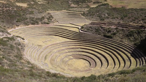
The purpose of these depressions is uncertain, but their depth, design, and orientation with respect to wind and sun creates a temperature difference of as much as 15 °C (27 °F) between the top and the bottom. It is possible that this large temperature difference was used by the Inca to study the effects of different climatic conditions on crops. Speculation about the site has led to discussion about Moray as an Inca agricultural experiment station. Its micro-climatic conditions and other significant characteristics led to the use of the site as a center for the ancient study of domestication, acclimatization, and hybridization of wild vegetable species that were modified or adapted for human consumption. (Wikipedia)
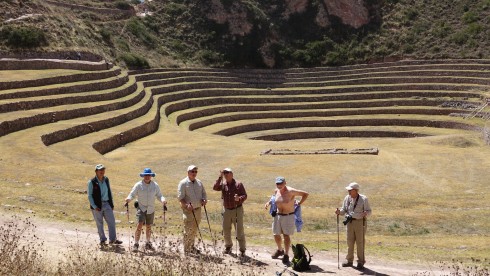
After exploring the many very interesting terraces, we were treated to an excellent picnic lunch with the lovely Helena serving a delightful meal and a good bottle of wine.
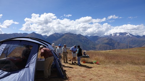
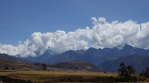
After lunch we traveled through the beautiful countryside, the higher peaks of the Andes filling the horizon…

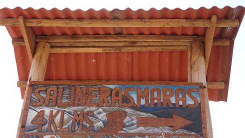
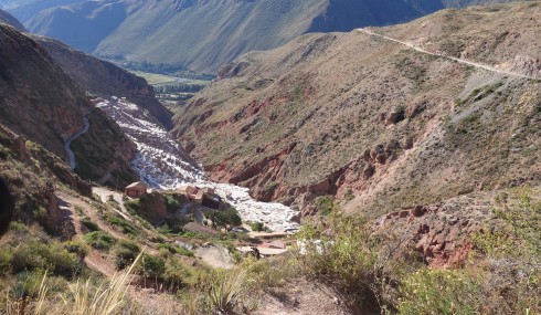
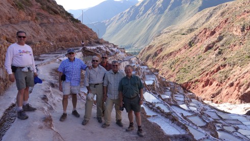
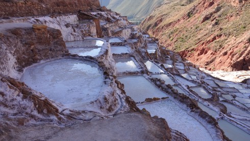
… and arrived at the trail head for our hike to Salinas, the salt pans established here centuries ago by the Incas.
The trek was mostly downhill through the most beautiful scenery.
Soon we arrived at the mountain pass above the ancient salt pans of Salinas. This was a strategic trading area in Inca times. The Inca established these pans to harvest salt from the very salty water coming from a spring deep inside the mountain. This is still a very important activity today, and hundreds of tons of salt is harvested here each year.
As the sun started its descent in the West, we made our way back for a lovely dinner and to rest up for another trek tomorrow.
>>>>>>>>>>>>>>>>>>>>>>>>>>>>>>>>>>>>>>>>>>>>>>>>>>>>
Thursday, May 19: Day 5
Ollantaytambo
Videos in this blog
![]() Hike from Pumamarca to Ollantaytambo
Hike from Pumamarca to Ollantaytambo
After breakfast we drove to the town of Ollantaytambo at the northern end of the Sacred Valley. A former Inca administrative center, it is the gateway to the Antisuyo (the Amazon corner of the Inca Empire)
An ancient switchback cobblestone road up the mountainside from the fertile valley below brings us into the town square from where we have an excellent view of the ancient Inca ruins we will explore this morning.
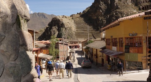
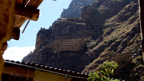
View of the fortress from the town square
At the time of the Spanish invasion and conquest of Peru, Ollantaytambo served as the last stronghold for Manco Inca, leader of the Inca resistance at the time. Nowadays the Ollantaytambo ruins and town are an important and popular tourist attraction in the Sacred Valley. The town’s primary attraction is the Ollantaytambo Fortress on the outskirts of the settlement in a section known as the Temple Hill.
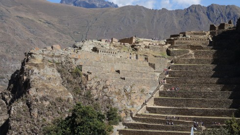
The fortress and Temple Hill
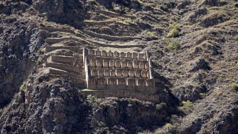
In the 15th century Inca Pachacutec conquered and began to rebuild the town of Ollantaytambo, constructing terraces for farming and an irrigation system. These huge terraces make up what is called the Fortress or Temple Hill.
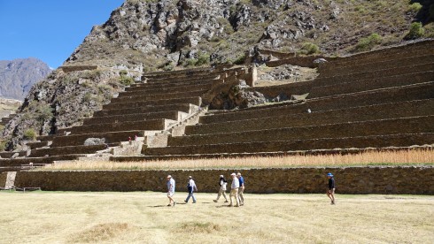
Our group in front of the massive agricultural terraces
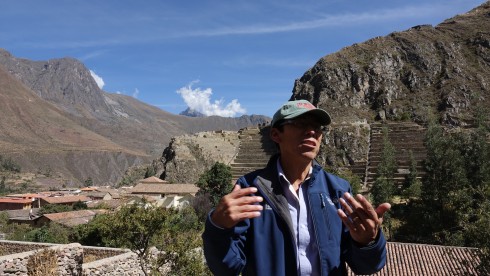
Our excellent guide, Thomas
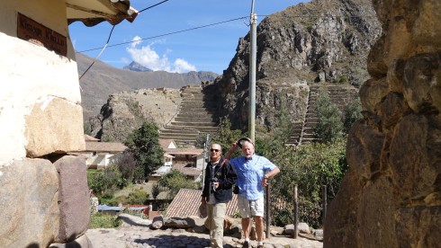
Dick and Bill with the Temple Hill in the background
The town became home to Inca nobility. After Inca Pachacutec’s death, the town and its surroundings fell to the hands of his family and then eventually into those of Manco Inca, who used Ollantaytambo as a retreat from the attacks of the Spanish. The fortress of Ollantaytambo, originally built for religious purposes, was the site of a major battle, one of the only successful ones against the conquistadors. From high above in the terraces of Ollantaytambo the Incas managed to hold back and defeat the Spanish. In addition they flooded the plain below forcing the Spanish to withdraw. With the Spanish defeated, Manco Inca retreated to the jungle stronghold of Vilcabamba shortly after the battle, knowing that the Spanish would return with even more force.  The fortress of Ollantaytambo was soon captured by Pizarro and his men. (Wikipedia)
We visited a local hotel courtyard, and were pleased to visit a working family home inside the huge walls where jim demonstrated the use of an ancient shovel, still in use today.
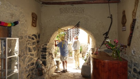
Entrance to a Hospidade (hotel) courtyard. Notice how thick the outer walls…
View of a granary storage high up the mountainside. The drier air enabled longer storage of their grain
The Face of Wiracocha and the Storehouses above the Town of Ollantaytambo
We explored some more of the town before taking of for our afternoon trek.
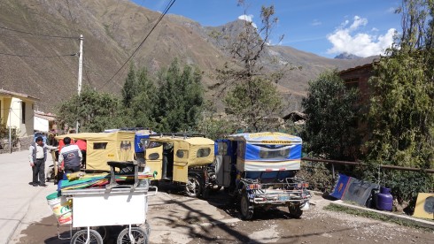
Taxi stand in Ollantaytambo
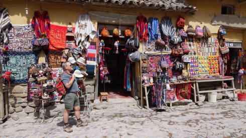
I bought a sweet little backpack for Lolly Grace Cooney, my two-month old granddaughter in New York                  Photo Credit: Thomas on Willie’s Sony
A narrow dirt road took us high into the Andes, through villages above the Sacred Valley to a lovely picnic spot to have lunch in the mountains – once again served by the lovely Helena – and to start our trek for the day.
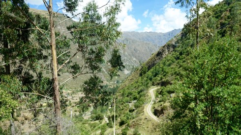
We drove up the narrow road to the Pumamarca campsite
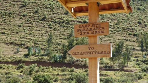
Start of our trek back to Ollantaytambo, almost 11,000 ft. Click on the image to be directed to a short video of this hike.
![]() Hike from Pumamarca to Ollantaytambo
Hike from Pumamarca to Ollantaytambo
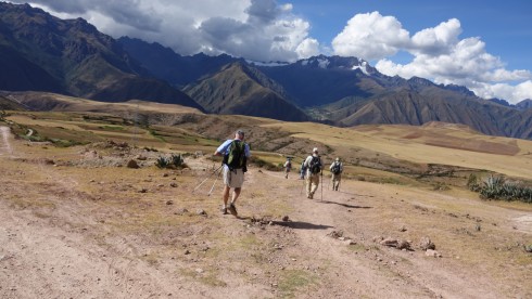
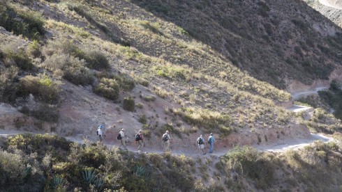
We set off on a beautiful trek through the mountains, walking along ancient terraces for much of the way. At one point Jim Macklin broke out in “The Hills are Alive”, and the whole group was inspired to sing “Climb Every Mountain”, not an easy feat at these altitudes!
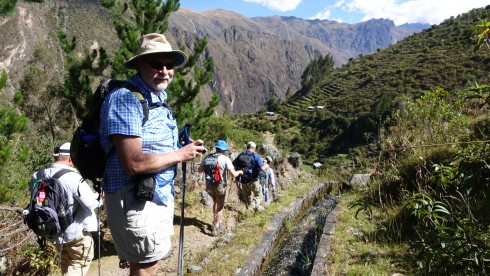
Bill at the start of the trail
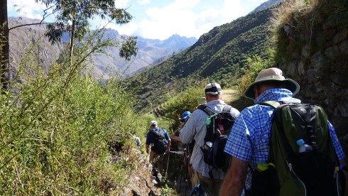
Amazing scenery!
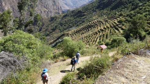
Amazing scenery – ancient terraces close to the end of the hike
These day treks were essential to prepare us for the difficult trek on the last leg of the Inca Trail tomorrow.
We were met at the trail-end by our driver, Wasi, and made it back to the hotel for our last night in Urubamba.
![]() Hike from Pumamarca to Ollantaytambo
Hike from Pumamarca to Ollantaytambo
Tomorrow we take off for the last leg trek on the Inca Trail, and for Mach Picchu!
See Blog Post 3
>>>>>>>>>>>>>>>>>>>>>>>>>>>>>>>>>>>>>>>>>>>>>>>>>>>>